Winter Weather Advisory: Western Plumas County/Lassen Park; West Slope Northern Sierra Nevada [expires: Dec 23, 2024 5:00 PM AST]
Winter Storm Warning: Yosemite NP outside of the valley; Upper San Joaquin River; Kaiser to Rodgers Ridge; Kings Canyon NP; Grant Grove Area; Sequoia NP [expires: Dec 23, 2024 10:15 AM AST]
Winter Weather Advisory: Northern Marinette County; Northern Oconto County; Door; Southern Marinette County; Southern Oconto County [expires: Dec 23, 2024 11:45 AM MST]
Winter Weather Advisory: Wood; Portage; Waupaca; Waushara [expires: Dec 23, 2024 11:45 AM MST]
Winter Weather Advisory: Vilas; Oneida; Forest; Florence [expires: Dec 23, 2024 11:45 AM MST]
Winter Weather Advisory: Outagamie; Brown; Kewaunee; Winnebago; Calumet; Manitowoc [expires: Dec 23, 2024 11:45 AM MST]
Winter Weather Advisory: Lincoln; Langlade; Menominee; Marathon; Shawano [expires: Dec 23, 2024 11:45 AM MST]
Winter Weather Advisory: Elkhart; Lagrange; Steuben; Northern La Porte; Eastern St. Joseph; Southern La Porte; Western St. Joseph; Cass; St. Joseph; Branch; Hillsdale; Northern Berrien; Southern Berrien [expires: Dec 23, 2024 12:00 PM CST]
Cold Weather Advisory: Dorchester; Inland Berkeley [expires: Dec 23, 2024 9:00 AM CST]
Winter Weather Advisory: Northern Herkimer; Southern Herkimer [expires: Dec 23, 2024 6:00 PM CST]
Winter Weather Advisory: Mason; Lake; Osceola; Clare; Oceana; Newaygo; Mecosta; Isabella; Montcalm; Gratiot [expires: Dec 23, 2024 11:15 AM CST]
Winter Weather Advisory: Allegan; Barry; Eaton; Ingham; Van Buren; Kalamazoo; Calhoun; Jackson [expires: Dec 23, 2024 11:15 AM CST]
Winter Weather Advisory: Muskegon; Ottawa; Kent; Ionia; Clinton [expires: Dec 23, 2024 11:15 AM CST]
Winter Weather Advisory: Spring Mountains-Red Rock Canyon [expires: Dec 23, 2024 2:00 PM AST]
Winter Weather Advisory: Eastern Clinton; Southeastern St. Lawrence; Southern Franklin; Western Clinton; Southwestern St. Lawrence; Grand Isle; Orleans; Essex; Western Chittenden; Caledonia; Washington; Eastern Addison [expires: Dec 23, 2024 5:00 PM CST]
Winter Weather Advisory: Northern St. Lawrence; Northern Franklin; Western Franklin; Lamoille; Eastern Franklin; Eastern Chittenden [expires: Dec 23, 2024 5:00 PM CST]
Winter Weather Advisory: Northern Coos; Southern Coos; Northern Grafton [expires: Dec 23, 2024 3:15 PM CST]
Winter Weather Advisory: Garrett; Extreme Western Allegany; Western Grant; Western Mineral; Western Pendleton [expires: Dec 23, 2024 2:00 PM CST]
Winter Weather Advisory: Washington; Frederick; Warren; Clarke; Morgan; Berkeley; Jefferson [expires: Dec 23, 2024 2:00 PM CST]
Winter Weather Advisory: District of Columbia; Frederick; Carroll; Northern Baltimore; Cecil; Southern Baltimore; Prince Georges; Anne Arundel; Northwest Montgomery; Central and Southeast Montgomery; Northwest Howard; Central and Southeast Howard; Northwest Harford; Southeast Harford; Fairfax; Arlington/Falls Church/Alexandria; Northern Fauquier; Western Loudoun; Eastern Loudoun; Northwest Prince William; Central and Southeast Prince William/Manassas/Manassas Park [expires: Dec 23, 2024 2:00 PM CST]
Winter Weather Advisory: Northern Cayuga; Oswego; Jefferson; Lewis [expires: Dec 23, 2024 1:00 PM CST]
Winter Weather Advisory: Interior Hancock; Central Washington; Coastal Hancock; Coastal Washington; Northern Washington [expires: Dec 23, 2024 5:00 PM CST]
Winter Weather Advisory: Northern Oneida; Southern Oneida [expires: Dec 23, 2024 4:00 PM CST]
Winter Weather Advisory: Southern Cayuga; Onondaga; Madison; Cortland; Chenango; Otsego [expires: Dec 23, 2024 4:00 PM CST]
Winter Weather Advisory: New Castle; Salem; Gloucester; Camden; Delaware; Philadelphia; Western Chester; Eastern Chester [expires: Dec 23, 2024 6:00 PM CST]
Winter Weather Advisory: Shiawassee; Genesee; Lapeer; St. Clair; Livingston; Oakland; Macomb [expires: Dec 23, 2024 4:00 PM CST]
Winter Weather Advisory: Washtenaw [expires: Dec 23, 2024 4:00 PM CST]
Winter Weather Advisory: Midland; Bay; Huron; Saginaw; Tuscola; Sanilac [expires: Dec 23, 2024 4:00 PM CST]
Winter Weather Advisory: Preston; Eastern Preston; Western Tucker; Eastern Tucker [expires: Dec 23, 2024 11:00 AM CST]
Winter Weather Advisory: Marquette; Green Lake; Fond Du Lac; Sheboygan; Columbia; Dodge; Washington; Ozaukee; Jefferson; Waukesha [expires: Dec 23, 2024 9:15 AM MST]
Winter Weather Advisory: Sauk; Iowa; Dane; Milwaukee; Lafayette; Green; Rock; Walworth; Racine; Kenosha [expires: Dec 23, 2024 9:15 AM MST]
Winter Weather Advisory: Southeast Webster; Northwest Pocahontas; Northwest Randolph; Southeast Randolph [expires: Dec 23, 2024 10:15 AM CST]
Winter Weather Advisory: Leelanau; Benzie; Grand Traverse; Manistee; Wexford; Gladwin; Arenac [expires: Dec 23, 2024 2:00 PM CST]
Winter Weather Advisory: Central Chippewa; Southeast Chippewa; Western Mackinac; Eastern Mackinac; Mackinac Island/Bois Blanc Island [expires: Dec 23, 2024 2:00 PM CST]
Winter Weather Advisory: Emmet; Cheboygan; Presque Isle; Antrim; Otsego; Montmorency; Alpena; Kalkaska; Crawford; Oscoda; Alcona; Missaukee; Roscommon; Ogemaw; Iosco; Beaver Island and surrounding islands; Charlevoix [expires: Dec 23, 2024 1:00 PM CST]
Winter Weather Advisory: Jackson; La Crosse; Monroe; Juneau; Adams; Vernon; Richland [expires: Dec 23, 2024 7:00 AM MST]
Winter Weather Advisory: Taylor; Clark [expires: Dec 23, 2024 7:00 AM MST]
Winter Weather Advisory: Municipality of Skagway [expires: Dec 23, 2024 4:00 AM ]
Winter Weather Advisory: Haines Borough and Klukwan [expires: Dec 23, 2024 4:00 AM ]
Flood Warning: Mason, WA [expires: Dec 23, 2024 5:00 AM AST]
Winter Weather Advisory: Bristol Bay [expires: Dec 23, 2024 9:00 AM ]
Flood Warning: Independence, AR; Jackson, AR; Lawrence, AR [expires: Dec 23, 2024 7:15 PM MST]
Flood Warning: Jackson, AR; Woodruff, AR [expires: Dec 23, 2024 7:15 PM MST]
Flood Warning: White, AR; Woodruff, AR [expires: Dec 23, 2024 7:15 PM MST]
Winter Weather Advisory: Copper River Basin [expires: Dec 23, 2024 4:00 PM ]
Winter Weather Advisory: Teton and Gros Ventre Mountains [expires: Dec 23, 2024 7:00 AM PST]
Winter Weather Advisory: South Slopes Of The Central Brooks Range [expires: Dec 23, 2024 7:00 AM ]
Winter Weather Advisory: Northern Denali Borough; Southern Denali Borough; Eastern Alaska Range North of Trims Camp; Eastern Alaska Range South of Trims Camp [expires: Dec 23, 2024 7:00 AM ]
Winter Storm Warning: Upper Koyukuk Valley [expires: Dec 23, 2024 7:00 AM ]
Winter Weather Advisory: Dalton Highway Summits [expires: Dec 23, 2024 7:00 AM ]
Winter Weather Advisory: Central Brooks Range [expires: Dec 23, 2024 7:00 AM ]
Winter Storm Warning: Upper Kobuk Valleys; Lower Koyukuk Valley [expires: Dec 23, 2024 7:00 AM ]
Winter Weather Advisory: Eastern Norton Sound and Nulato Hills; Yukon Delta Coast [expires: Dec 23, 2024 7:00 AM ]
Winter Weather Advisory: Lassen-Eastern Plumas-Eastern Sierra Counties [expires: Dec 23, 2024 3:15 PM AST]
Winter Weather Advisory: Mono [expires: Dec 23, 2024 3:15 PM AST]
Winter Weather Advisory: Greater Lake Tahoe Area; Greater Lake Tahoe Area [expires: Dec 23, 2024 3:15 PM AST]
Air Quality Alert: San Bernardino and Riverside County Valleys-The Inland Empire; Riverside County Mountains; San Gorgonio Pass Near Banning; Orange County Coastal; Orange County Inland [expires: Dec 24, 2024 12:00 AM AST]
Air Quality Alert: Catalina and Santa Barbara Islands; Santa Clarita Valley; Malibu Coast; Los Angeles County Beaches; Palos Verdes Hills; Los Angeles County Inland Coast including Downtown Los Angeles; Western Santa Monica Mountains Recreational Area; Eastern Santa Monica Mountains Recreational Area; Calabasas and Agoura Hills; Western San Fernando Valley; Eastern San Fernando Valley; Santa Susana Mountains; Los Angeles County San Gabriel Valley [expires: Dec 24, 2024 12:00 AM AST]

Welcome to Storm Chaser Rhodes

Covering Severe Weather Across the United States

Welcome to The Rhodes Weather Team!

Welcome to the Rhodes Weather Team, your premier source for comprehensive severe weather coverage across the United States. Our dedicated team of weather enthusiasts is committed to providing timely, accurate, and detailed information to keep you informed and safe.

Whether it's hurricanes, tornadoes, or severe thunderstorms, we are here to deliver the latest updates, analysis, and essential safety tips.

Join our community to stay ahead of the storm and ensure you and your loved ones are always prepared for whatever Mother Nature has in store.

Our Goal

Our Goal is be a source of up to date weather information! Live streams on our social media accounts will occur, it will only be during times of severe weather and large weather outbreaks; however, we still want to be able to be a source of weather information even when live streams are not available.

Our webpage is filled with various real time weather warnings, watches, advisories, and alerts - all pulled in real time from the National Weather Service. Active alerts will always scroll across the bottom of our page, you can find active warnings listed in each section of our page below. Please be sure to refresh the page often for the most up to date alerts.

Your safety is also highly important! Along with real time weather warnings, watches, advisories, and alerts we have links to safety information from various governmental agencies in our navigation bar and next to each of the possible alerts through our page!

Thank you for joining us and dont forget to connect via any or all of our social media accounts!

Join the Storm Chaser Rhodes Community!

Tornado & Severe Storm Outlook

Active Alerts
  • Tornado Warnings 0
  • Severe Thunderstorm Warnings 0
  • Tornado Watch 0
  • Severe Thunderstorm Watch 0


Detailed Warning and Watch Information

There are no Current Tornado or Severe Thunderstorm Warnings or Watches.


Meso Discussions from SPC
RSS Mesoscale Discussions from Storm Prediction Center No Mesoscale Discussions are in effect as of Sun Dec 22 19:16:02 UTC 2024.

Flooding Outlook

Active Alerts
  • Flash Flood Warnings 0
  • Flood Warnings 4
  • Flash Flood Watch 0
  • Flood Watch 0

Detailed Warning and Watch Information

WPC Heavy Rainfall Outlook

Excessive Rainfall Discussion
NWS Weather Prediction Center College Park MD
258 AM EST Mon Dec 23 2024
Day 1
Valid 12Z Mon Dec 23 2024 - 12Z Tue Dec 24 2024

...THERE IS A MARGINAL RISK OF EXCESSIVE RAINFALL FOR PORTIONS OF
NORTHERN CALIFORNIA AND SOUTHWEST OREGON...

The next atmospheric river will make headway into southwest OR and
northwest CA coastal plain with a protrusion of elevated IVT inland
as we work the back end of the period. Consistency among all major
deterministic, both global and hi-res indicate a widespread area of
2-4" with locally as high as 5.5" in-of the impacted areas, mainly
north of Santa Rosa up into southwest OR. Latest HREF probs for >3"
are very high (80+%) across areas like the King and Siskiyou Ranges
along with the Foothills of Mount Shasta. Despite the elevation, a
strong warm nose with this event will send snow levels spiking
upwards with the base pushing close to 8000ft MSL for the
rain/snow delineation point. This will create a better heavy
rain threat even away from the coast with areas inland also
maintaining a threat for localized flash flood concerns, especially
as we move into early Tuesday morning. The heaviest rainfall will
likely be within those coastal ranges which are some of the harder
areas to flood, so that will help limit the extensive flash flood
prospects we see with some events. The progressive nature of the AR
regime will also aid in the anticipated impacts, however the threat
is still within the low to medium end of the MRGL risk threshold
leading to a continuance of the MRGL from the previous forecast
issuance. The area(s) with the greatest potential are those that
are still dealing with burn scar aftermath with very sensitive
runoff capabilities. Those are included within the MRGL risk,
especially across northern CA.

Kleebauer


Day 1 threat area: <a href="https://www.wpc.ncep.noaa.gov/qpf/94epoints.txt"<u>www.wpc.ncep.noaa.gov/qpf/94epoints.txt</u></a>

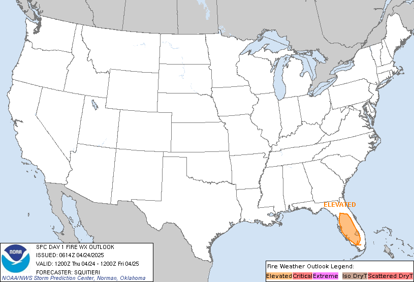
Fire Outlook

Active Alerts
  • Red Flag Warning 0
  • Fire Warning 0
  • Fire Weather Watch 0
  • Extreme Fire Danger 0

Detailed Warning and Watch Information

There are no Current Fire related Warnings or Watches.


Fire Weather Discussions from SPC

   ZCZC SPCFWDDY1 ALL
   FNUS21 KWNS 230700

   Day 1 Fire Weather Outlook  
   NWS Storm Prediction Center Norman OK
   0100 AM CST Mon Dec 23 2024

   Valid 231200Z - 241200Z

   ...NO CRITICAL AREAS...

   ...Synopsis...
   Fire-weather concerns will be minimal today. Locally dry/breezy
   conditions are possible in the vicinity of a weak lee cyclone over
   the southern High Plains, though surface winds should remain too
   light for a fire-weather threat.

   ..Weinman.. 12/23/2024

   ...Please see www.spc.noaa.gov/fire for graphic product...

   CLICK FOR <a href="/products/fire_wx/2024/241223_1200_day1pts.txt">DAY 1 FIREWX AREAL OUTLINE PRODUCT (KWNSPFWFD1)</a>
      

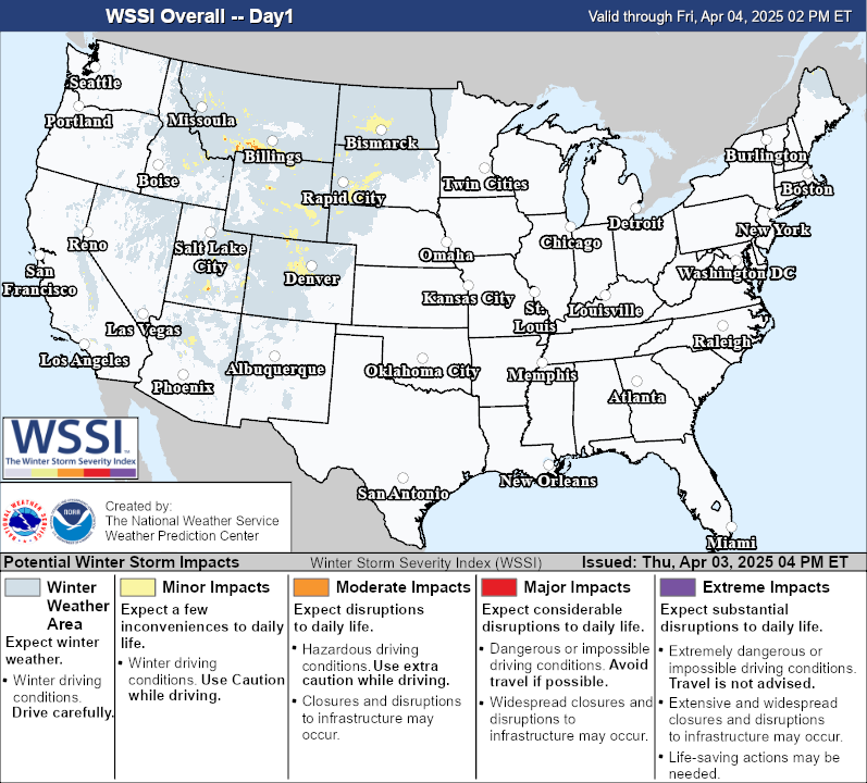
Winter Weather Outlook

Active Alerts
  • Blizzard Warnings 0
  • Winter Storm Warnings 3
  • Ice Storm Warning 0
  • Winter Weather Advisory 48
  • Winter Storm Watch 0
  • Lake Effect Snow Warning 0
  • Snow Squall Warning 0

Detailed Warning and Watch Information

Winter Weather Safety Information
WPC Winter Weather Outlook

<font face="arial,helvetica">
Probabilistic Heavy Snow and Icing Discussion
NWS Weather Prediction Center College Park MD
257 AM EST Mon Dec 23 2024

Valid 12Z Mon Dec 23 2024 - 12Z Thu Dec 26 2024


...The West...
Days 1-3...

An active pattern continues this week with mountain snow expected
from the West Coast mountain ranges to both the Northern and
Central Rockies. This stormy pattern in the short range is due to
three atmospheric rivers (ARs) bringing plume after plume of
Pacific moisture into the western U.S.. The first AR will gradually
weaken throughout the remainder of the day, but residual Pacific
moisture and a lack of a meaningfully cold air will keep most
heavy snowfall in the Northern Rockies above 7,000ft. Snow should
taper off over the Northern Rockies by Monday evening.

The second AR arrives Monday evening with IVT values topping 1,000
kg/m/s off the Oregon coast and moisture origins stemming out of
the subtropical Pacific. The initial round of precipitation
arriving Monday afternoon will be primarily rain in northern CA,
western OR, and western WA as snow levels in the OR Cascades are as
high as 8,000ft and even topping 9,000ft in northern CA. The
Cascades and Blue Mountains will have the better odds of staying
mostly snow above 5,000ft. By Tuesday morning, sharper 700-500mb
height falls from the approaching upper trough will force snow
levels to drop as low as 3,000ft at pass level in the WA Cascades
and below 6,000ft in the Sierra Nevada by Tuesday afternoon. The
Sierra Nevada have the best odds for an impactful snowfall event
with the Winter Storm Outlooks now sporting 50% odds of snowfall
exceeding warning criteria for elevations >7,000ft. Periods of
high elevation snow in the Great Basin and Wasatch are likely
Tuesday night but heavier accumulations (>4") will be mostly
confined to elevations at/above 8,000ft. Through 12Z Wednesday, WPC
probabilities show moderate-to-high chances (50-70%) for snowfall
>8" above 7,000ft in the Sierra Nevada, above 5,000ft in the
Cascades/Olympics/Blue Mountains, and above 8,000ft in the Tetons.

The third and more expansive AR arrives Wednesday as a powerful
sub-960mb low tracks towards the British Columbia coast. NAEFS
shows this AR with moisture origins northwest of Hawaii that will
be directed at the Pacific Northwest, including IVT values topping
the 97.5 climatological percentile. Unlike the first pair of ARs,
this one will have a slightly colder air-mass to work with at the
onset while mean 700-300mb winds out of the WSW are better aligned
orthogonally to enhance upslope ascent into the Olympics and
Cascades. This is a recipe for heavy/wet snow in the Olympics and
Cascades Wednesday afternoon and into Wednesday night. Latest WPC
probabilities show high chances (>70%) for >8" of snowfall for
elevations >3,000ft, and similar chances for >12" of snowfall
above 5,000ft. The WSSI-P does show 50-70% odds for Moderate
Impacts in these ranges through Thursday AM, which would include
some of the WA Cascade passes.


...Northern Plains, Great Lakes, to Northeast...
Days 1-2...

A positively tilted 250-500mb trough over the Midwest this morning
is providing sufficient upper-level ascent over the Great Lakes and
supporting a weak area of low pressure tracking towards southern
Wisconsin. Broad 850mb WAA and 290K isentropic glide via SWrly flow
will introduce a slug of Gulf of Mexico moisture (embedded within a
>300 kg/m/s IVT) into the region which maintains sub-freezing
boundary layer temperatures as the precipitation arrives. This
will result in periods of snow on the north side of the low that
stretches from southeast MN and central WI to northern MI today and
into tonight. WPC probabilities show moderate-to-high chances
(50-70%) for snowfall totals >4" across the northern tier of
Michigan's Mitten with low chances (10-30%) or >6". Some light
icing is possible in parts of southeast MN, western WI, southern
MI, and northern IN where there are moderate-to-high chances
(50-70%) for ice accumulations >0.01". With ground temperatures so
cold, even minor amounts <0.1" can cause slick conditions on
roadways.

As the storm heads east Monday night, storm system will direct its
anomalous moisture source and modest low-level WAA into the
Northeast. Modest upper-level divergence in the form of a
strengthening 250mb jet streak aloft provides support for the
healthy shield of precipitation throughout the region, while the
air-mass remains quite cold and dry ahead of the storm (temps in
the teens,single-digit dew points). Higher SLRs of 12-16:1 are
anticipated in these areas and soil temperatures are near freezing,
which combined with the event occurring at night, will maximize
snowfall accumulation potential. The storm races off over Nova
Scotia by midday Tuesday and snowfall should taper off by Tuesday
afternoon. WPC probabilities show moderate-chance probabilities
(40-60%) for snowfall >6" in parts of northern NY (including the
Tug Hill) and in the tallest peaks of the Green and White
Mountains. These mountain ranges are favored for the heaviest
snowfall given the added help of upslope flow. Downeast Maine
sports moderate-chance probabilities for >6" of snowfall through
Tuesday morning. For those affected areas listed above, the WSSI-P
has increased its chances for Minor Impacts to moderate-to-high
chances (50-70%) from northern MI on east through northern NY and
into northern New England.

...Mid-Atlantic...
Day 2...

Residents in the Mid-Atlantic will want to monitor the forecast
closely Tuesday morning as the same tongue of moisture bringing
snow to the Northeast could bring a swath of light snow and/or
wintry mix from the central Appalachians to the New Jersey Shore.
Soils temperatures are close to freezing and light ice or snow
accumulations could make for slick travel conditions Christmas Eve
morning. WPC probabilities do show some low chance probabilities
(10-30%) for ice accumulations >0.01" in parts of the DC,
Baltimore, and Philadelphia metropolitan areas Tuesday morning.
Odds of >0.01" ice accumulations (low-to-moderate chances, or
30-50%) are greater to the west of these cities in parts of
northern MD, southeast PA, and the central Appalachians.


Mullinax


</font>

Cold Weather Outlook

Active Alerts
  • Extreme Cold Warning 0
  • Extreme Cold Watch 0
  • Freeze Warning 0
  • Freeze Watch 0
  • Cold Weather Advisory 1
  • Frost Advisory 0
Detailed Warning and Watch Information

Cold Weather Safety Information

Extreme Heat Outlook

Active Alerts
  • Excessive Heat Warning 0
  • Heat Advisory 0
  • Excessive Heat Watch 0
  • Air Quality Alert 2

Detailed Warning and Watch Information


Climate Forecast and Discussions from CPC

Maximum Heat Index for Dec 26, 2024

Copyright 2024 Chris Rhodes Storm Photographer

Warning & Watch Information
Warning and Watch infomation is pulled directly from the National Weather Service. This page does not automatically refresh, please refresh to see a list of up to date warning and watches. For your safety please ensure you always have a way to get weather watches and warnings for your area. Never base important decisions that could result in harm to people or property on this weather information.

Alert Disclaimer and Info
This page only displays selected Watches and Warnings based on Tornado, Severe Thunderstorms, Floods, Tropical Storms, Fire, and Heat. Please monitor your local weather sources for other warnings and watches that are issued by the National Weather Service or local officials. Please visit the National Weather Service Page for a complete list of all watches and warnings.